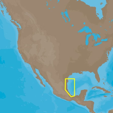
C-map 4d na-d946 brownsville, tx to coatzacoalcos, mx
Attributes
Distributor offers
| Seller | SKU | MOQ | In stock | Multiple | Prices |
|---|---|---|---|---|---|
| SavingLots | NA-D946 | 1 | 5 | 1 | 1 @ $187.50 |
| westmarine.com | 16306151 | 1 | 1 | ||
 Zoro Zoro | G4682712 | 1 | 1 | 1 @ $221.42 | |
 iboats.com iboats.com | IB1214143 | 1 | -2 | 1 | 1 @ $199.00 |
| NA-D946 | 1 | 5 | 1 | 1 @ $199.00 | |
 Anchor Express Anchor Express | 50315 | 1 | 1 | 1 @ $199.00 | |
 delawarepaddlesports.com delawarepaddlesports.com | NA-D946 | 1 | -2 | 1 | 1 @ $199.00 |
| landfallnavigation.com | ECNAD946 | 1 | 1 | 1 @ $199.00 | |
| marine.com | 11-50315 | 1 | 1 | ||
 cemarine.com cemarine.com | 50315 | 1 | 1 | 1 @ $199.00 | |
 ritelinemarine.com ritelinemarine.com | 50315 | 1 | 1 | 1 | 1 @ $199.00 |
Related on Amazon
As an Amazon Associate, we earn from qualifying purchases. (paid link) CERTAIN CONTENT THAT APPEARS ON THIS SITE COMES FROM AMAZON. THIS CONTENT IS PROVIDED 'AS IS' AND IS SUBJECT TO CHANGE OR REMOVAL AT ANY TIME.
C-MAP 4D NA-D946 Brownsville, TX to Coatzacoalcos, MX
Brand: C-MAP
Catalog
| Feature | 4D NA-D946 Brownsville, TX to Coatzacoalcos, MX |
|---|---|
| Category | Electronics |
| MPN | NA-D946 |
| UPC | 647367797541 |
| EAN | 6521515401983 |
| Product group | CE |
| Product type | INK_OR_TONER |
| Manufacturer | C-Map |
C-MAP 4D NA-D946 Brownsville, TX to Coatzacoalcos, MX [NA-D946]
Brand: C-MAP
C-MAP 4D NA-D946 Brownsville, TX to Coatzacaolcos, MXThe next evolution in navigation solutions. C-MAP 4D adapts to your boating needs because it's the only digital chart that offers advanced features and lets you add data and services as they become available.Full 4D ContentWhen you choose Full 4D content you will experience the latest in navigationdata and technology such as:3D Chart View - The world has three dimensions.When you add the 4th dimension of time - meaning consistent, periodicupdates - you combine the most detailed 3D height and depth worldwidedatabase with a continuous update process to give you a personalizednavigation experience with up-to-date data for safe navigation.High-Resolution Satellite Imagery - See the real world on yourscreen.C-MAP 4D includes a navigational perspective with high-resolution coastalimagery overlaid on the most accurate and up-to-date vector data, plusthousands of extraordinary photos for the most popular marinas and areas ofinterest.Digital Raster Charts - Innovate tradition.With raster charts, you have an additional reference source for navigationalawareness. Get "at-a-glance" information using the nautical paper chartsoverlaid on the multi-dimensional shaded relief to have a new visualexperience.Easy Routing - Automatically create a route.Enter start and end points along with specific boat parameters andautomatically receive waypoints of the shortest route; highlights potentialhazards and displays varying levels of alerts for each segment of the route,allows you to manually adjust the route.Guardian Alarm - An extra layer of safety.When activated, Guardian Alarm performs an automatic forward-scanning checkfor obstacles. Use the feature as an added backup to alert you should youhead toward a potentially harmful object.Detailed NavAidsRoute CheckDetailed Marina ChartsC-Marina Ports DatabaseMulti-Language CapabilityDynamic Tides & CurrentsPhotos & DiagramsDepths & Land ElevationsPerspective View4D cartography is compatib
Details
- Actuator Type = NONE
- Card Format = MicroSD/SD
- Excellent product
- 100% satisfaction
C-MAP NA-D946 4D NA-D946 Brownsville44; TX to Coatzacoalcos44; MX
Brand: C-MAP
C-MAP 4D NA-D946 Brownsville TX to Coatzacaolcos MXThe next evolution in navigation solutions. C-MAP 4D adapts to your boating needs because its the only digital chart that offers advanced features and lets you add data and services as they become available.Full 4D ContentWhen you choose Full 4D content you will experience the latest in navigationdata and technology such as:. 3D Chart View - The world has three dimensions.When you add the 4th dimension of time - meaning consistent periodicupdates - you combine the most detailed 3D height and depth worldwidedatabase with a continuous update process to give you a personalizednavigation experience with up-to-date data for safe navigation.. High-Resolution Satellite Imagery - See the real world on yourscreen.C-MAP 4D includes a navigational perspective with high-resolution coastalimagery overlaid on the most accurate and up-to-date vector data plusthousands of extraordinary photos for the most popular marinas and areas ofinterest.. Digital Raster Charts - Innovate tradition.With raster charts you have an additional reference source for navigationalawareness. Get at-a-glance information using the nautical paper chartsoverlaid on the multi-dimensional shaded relief to have a new visualexperience.. Easy Routing - Automatically create a route.Enter start and end points along with specific boat parameters andautomatically receive waypoints of the shortest route; highlights potentialhazards and displays varying levels of alerts for each segment of the routeallows you to manually adjust the route.. Guardian Alarm - An extra layer of safety.When activated Guardian Alarm performs an automatic forward-scanning checkfor obstacles. Use the feature as an added backup to alert you should youhead toward a potentially harmful object.. Detailed NavAids. Route Check. Detailed Marina Charts. C-Marina Ports Database. Multi-Language Capability. Dynamic Tides & Currents. Photos & Diagrams. Depths & Land Elevations. Perspective View4D cartogr
Details
- 3D Chart View - The world has three dimensions.<br/>When you add the 4th dimension of time - meaning
- High-Resolution Satellite Imagery - See the real world on your<br/>screen.<br/>C-MAP 4D includes a navigational
- Digital Raster Charts - Innovate tradition.<br/>With raster charts, you have an additional reference
- Easy Routing - Automatically create a route.<br/>Enter start and end points along with specific boat
- Guardian Alarm - An extra layer of safety.<br/>When activated, Guardian Alarm performs an automatic