C-Map . NA-Y041
Gallery

Attributes
Distributor offers
| Seller | SKU | MOQ | In stock | Multiple | Prices |
|---|---|---|---|---|---|
| iboats.com | IB00636951 | 1 | -2 | 1 | 1 @ $98.26 |
 unbeatablesale.com unbeatablesale.com | CW59198 | 1 | Out Of Stock | 1 | 1 @ $103.37 |
| marine.com | 11-57704 | 1 | 1 |
Related on Amazon
As an Amazon Associate, we earn from qualifying purchases. (paid link) CERTAIN CONTENT THAT APPEARS ON THIS SITE COMES FROM AMAZON. THIS CONTENT IS PROVIDED 'AS IS' AND IS SUBJECT TO CHANGE OR REMOVAL AT ANY TIME.

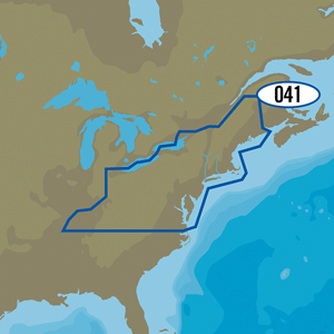
C-MAP MAX-N NA-Y041 - US Northeast Lakes
Brand: C-MAP
MAX-N+ NA-Y041 - US Northeast LakesMAX-N+ brings all the popular C-MAP 4D features to the the Navico family ofchartplotters, including: Detailed Harbor Charts, Dynamic RasterCharts,High-Resolution Satellite Imagery, Custom Shaded Depths, DynamicTides & Currents, High-Resolution Bathymetric Data, Sport Fishing Data,Aerial Photos, C-Marina Port Info & Multi-Language Charts.C-MAP MAX-N+ brings trusted Jeppesen data and advanced charting features tousers of compatible Lowrance, Simrad and B&G navigation systems.Whether you're an avid saltwater angler, sailing enthusiast or long-rangecruiser, these powerful charts will enhance every moment you spend on thewater. With huge coverage areas, up-to-date data and state-of-the-artfeatures, no adventure is out of reach.Software Requirements:Simrad NSO evo2 - Software Version 4.0Simrad NSS evo2 - Software Version 3.0B&G Zeus2 - Software Version 3.0Lowrance HDS Gen2 - Software Version 4.0Lowrance HDS Gen2 Touch - Software Version 4.5Lowrance HDS Gen3 - Software Version 2.0Features:Dynamic Raster Charts - Give sailors a traditional ""nautical chart""view with the ability to access important information. High-ResolutionBathymetric (HRB) charts and Sportfishing Data deliver powerful technologyfor avid anglers. Tides & Currents projections help both sailors and anglersplan their dayFull-Featured Vector Charts - Provide boaters with the accurate,up-to-date vector chart detail including Depth Areas and Contours, SpotSoundings, NavAids, Light Sectors, Wrecks/Obstructions, Small CraftFacilities and moreHarbor & Approach Details - Lets boaters approach any harbor and inletwith confidence - the perfect conclusion to a long voyage, sailing adventureor exciting day of bluewater fishingTides & Currents - Presents the time, water level and direction of tideswith Tide Level graphs and indicates predicted current time, direction andstrength of currents with Current Flow graphs and colored arrows. Thisinformation is vital for navigation and fishi
Details
- Hewitt
Listing
| Binding | Office Product |
|---|---|
| Product group | Sports |
| Product type | EDUCATIONAL_SUPPLIES |
| Part number | NA-Y041 |
| Items per pack | 1 |
| Label | C-MAP |
| Manufacturer | C-MAP |
Catalog
| Feature | 3-D View NONE |
|---|---|
| Category | Electronics |
| MPN | NA-Y041 |
| Product group | Sports |
| Product type | EDUCATIONAL_SUPPLIES |
| Manufacturer | C-MAP |
C-MAP MAX-N+ NA-Y041 - US Northeast Lakes
Brand: C-MAP
Catalog
| Feature | Hewitt |
|---|---|
| Category | Office Products |
| MPN | NA-Y041 |
| Product group | BISS |
| Product type | MECHANICAL_COMPONENTS |
| Manufacturer | C-MAP |